


Ascension au fort saint Eynard

choubaka77
User
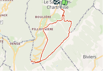

Length
9.2 km

Max alt
1343 m

Uphill gradient
626 m
Km-Effort
17.6 km

Min alt
989 m

Downhill gradient
625 m
Boucle
Yes
Creation date :
2020-09-02 12:18:08.0
Updated on :
2020-09-05 07:47:59.058
4h07
Difficulty : Difficult

FREE GPS app for hiking
 SityTrail
IGN / Geographical institutes
SityTrail Plus
The world is yours!
About
Trail Walking of 9.2 km to be discovered at Auvergne-Rhône-Alpes, Isère, Le Sappey-en-Chartreuse. This trail is proposed by choubaka77.
Description
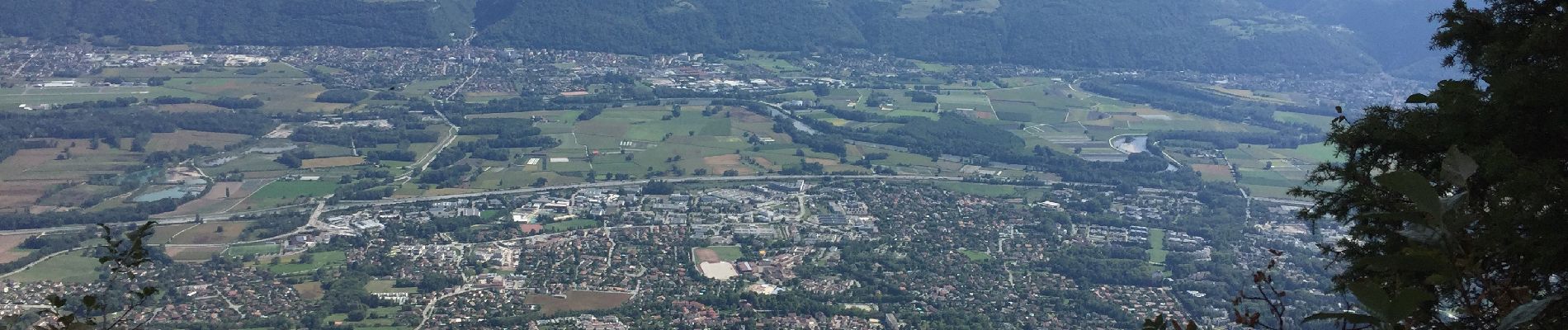
Très beaux points de vue durant la balade le long de la falaise. Attention date d’ouverture du fort. Montée et descente assez raide !!!
Photos


Positioning
Country:
France
Region :
Auvergne-Rhône-Alpes
Department/Province :
Isère
Municipality :
Le Sappey-en-Chartreuse
Location:
Unknown
Start:(Dec)
Start:(UTM)
718053 ; 5015382 (31T) N.
Comments